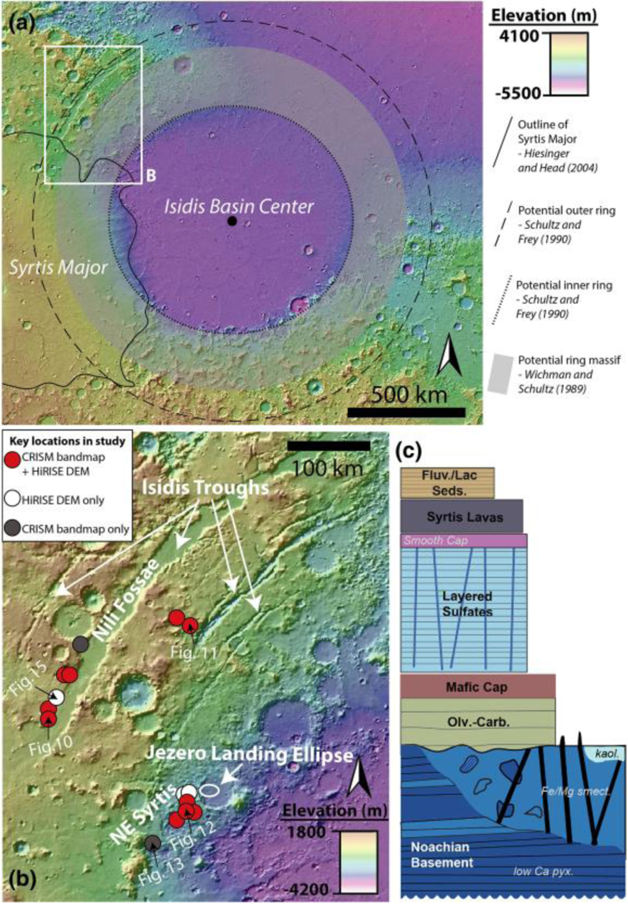
Figure 1.

(a) MOLA topography map of Isidis basin and Syrtis Major. Outlines refer to suggested impact basin features from previous literature. White box denotes position of panel (b). (b) Map of main study area. Circles refer to key stratigraphic locations used in this study. Red circles refer to the position of CRISM bandmaps with HiRISE DEMs, white circles refer to HiRISE DEMs only, and the gray circle refers to CRISM bandmap only. The location of data shown in Figures 10–15 is indicated with black arrows. (c) Regional stratigraphy of study area within panel (b). The regional stratigraphy represents a summarization of Mustard et al. (2009), Ehlmann and Mustard (2012), Goudge et al. (2015), Bramble et al. (2017), and Quinn and Ehlmann (2019a).
