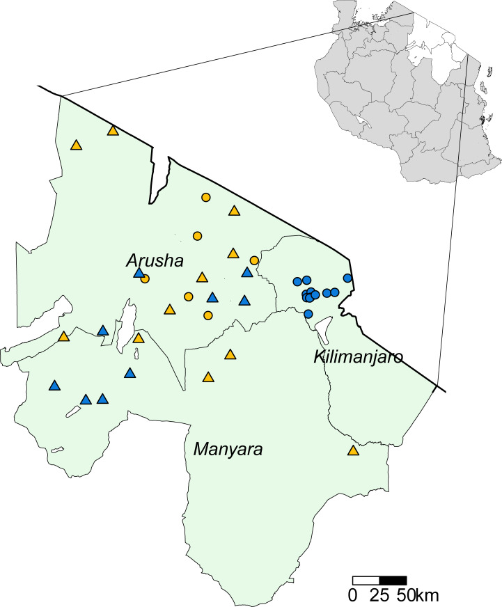
Fig 1. Livestock sampling locations in Arusha, Kilimanjaro, and Manyara Regions (green shading), Tanzania.
Solid black line represents the border with Kenya. Circles show the villages sampled for the BacZoo study between 2013 and 2015. Triangles show the villages sampled for the SEEDZ study in 2016. Yellow represents pastoral villages and blue represents non-pastoral villages sampled. In the top right insert, white polygons show Arusha, Kilimanjaro and Manyara Region locations within an outline map of Tanzania (grey shading). Map created using R software 3.6.1 [62] and the tmap R package [65]. Administrative boundary shapefile sourced from the Tanzania National Bureau of Statistics, https://www.nbs.go.tz/index.php/en/census-surveys/population-and-housing-census/172-2012-phc-shapefiles-level-one-and-two [66].

