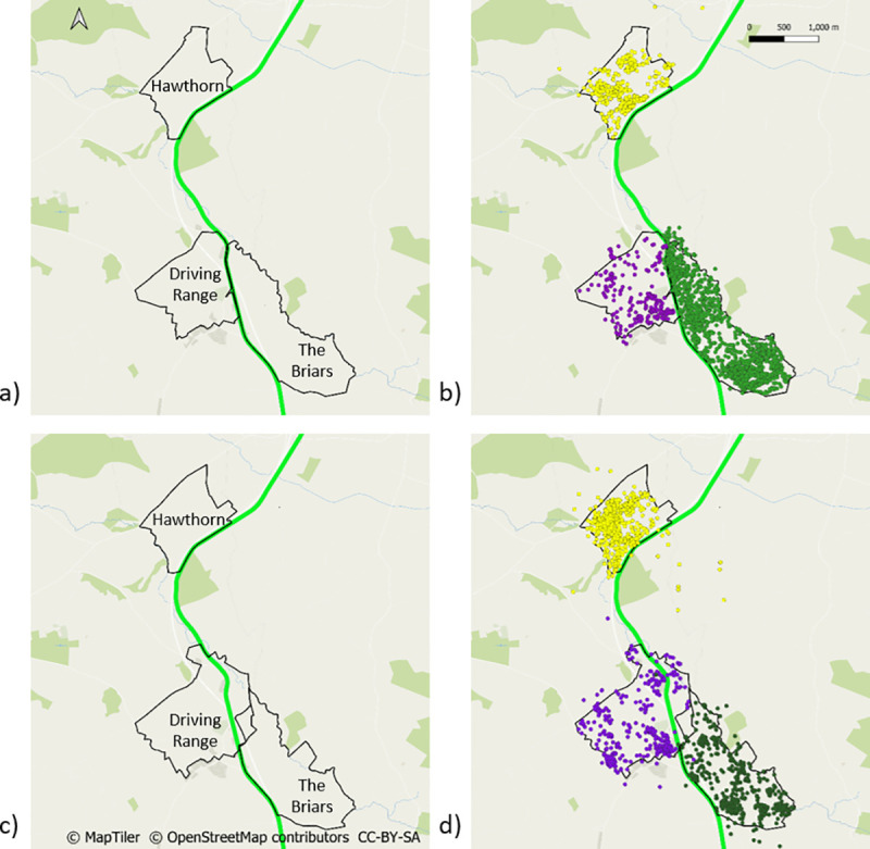
Fig 3. Territory boundaries and road crossings.

a) Territory boundaries of three of the social groups before road construction outlined in black; b) GPS locations for badgers from each of these social groups before road construction: Hawthorn in yellow, Driving Range in pink and The Briars in green; c) territory boundaries of the same three social groups after road construction outlined in purple and d) GPS locations for badgers from of these each social groups after road construction. The location of the N11 road is represented by a green line. The location of the M11 motorway is represented by a blue line. The locations of underpasses are represented by red dashes intersecting the M11. The N11 has been omitted from map d) for clarity.
