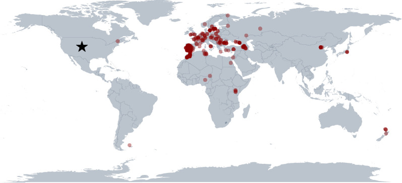
Figure 2.
Our current understanding of the global range of SGS1. This map was generated using 357 SGS1 reports that had corresponding GPS data in addition to our observations of SGS1 infecting black-capped (Po. atricapillus) and mountain (Po. gambeli) chickadees in Boulder, Colorado (indicated by the star). Points are semi-translucent, and they overlap in some locations. This map was generated using the ggplot2 R package [24,25].

