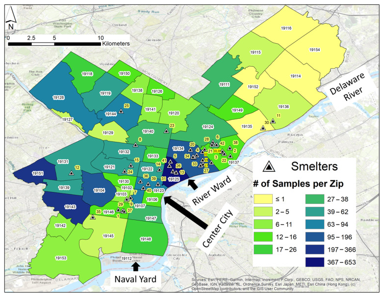
Figure 2.
Map of Philadelphia, separated by ZIP codes. The color of each ZIP-code area corresponds to the number of soil sample points. Former smelter/processor sites are referred to above as “Smelters” for simplicity and are labeled as black triangles with white edges and numbered, with numbers highlighted with a yellow halo. Note, sites 10 and 18 overlap and are represented by one triangle. See Table S1a,b for sample site coordinates and view Table S2 for smelter/processor site details. Key points of interest are labeled on the map.

