
Figure 4.
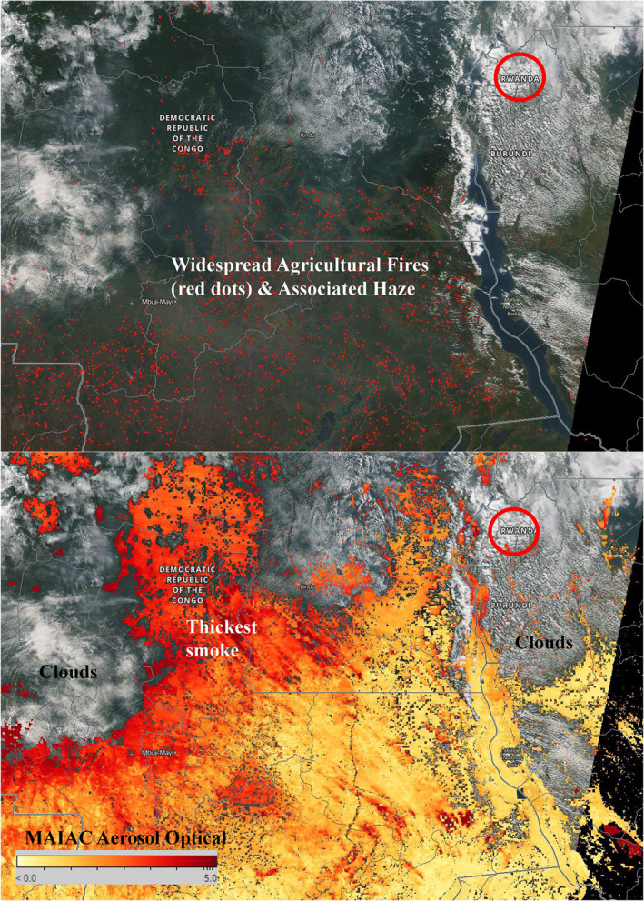
Moderate resolution Imaging Spectrometer fire‐counts (top) and aerosol optical depth (bottom) satellite data on June 9, 2020 accessed from Worldview. Rwanda is indicated with a red circle and was experiencing mostly cloudy skies at the time of the satellite overpass.