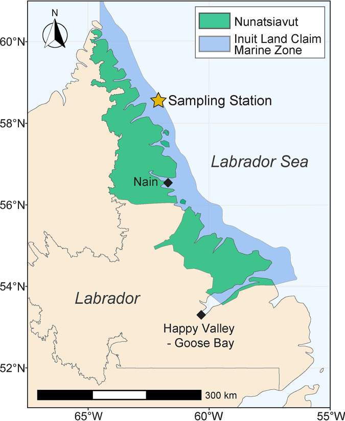
FIG 1.
Map of Labrador and the Labrador Sea. Sampling station (star) marks where marine sediment was collected in triplicate in 2015 (cross-reference with Table S1 in the supplemental material). Sampling occurred within the marine zone of the Nunatsiavut Inuit Land Claim Agreement (blue shaded area along the coast).

