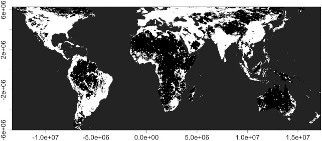
Fig. 1.
Spatial variation in artificial light at night over the global land surface. The layer gives an estimated combined extent of direct emissions and skyglow between 59°N and 55°S at 1.61 × 1.21 km resolution in Behrmann equal area projection (see Cox et al. 2020a for a full description of methods). In brief, the layer gives VIIRS day/night band (DNB) values corrected for albedo and skyglow. To avoid the confounding effects of the aurora and permanent snow and ice, we excluded pixels above 59°N and 55°S. Once albedo had been removed, DNB airglow was detected over the majority of the land surface. Airglow varies with latitude and therefore to provide the best possible mask while minimizing the obscuring of true direct ALAN emissions, for each 200 km latitudinal band we calculated the median DNB value and converted all values below the median to 0 (mean across latitudinal bands 0.098; min 0.015, max 0.202). To incorporate skyglow we used values for artificial brightness from the New World Atlas of Artificial Sky Brightness (Falchi et al. 2016). Following Falchi et al. (2016), we set artificial brightness values below 0.00,174 mcd/m2 to 0, because these were considered indistinguishable from a pristine night sky. To map the extent of both forms of ALAN, values of skyglow were added to values of direct ALAN emissions before converting all values greater than 0 to 1. and thereby creating a binary layer of where ALAN is present (white) or absent (black).

