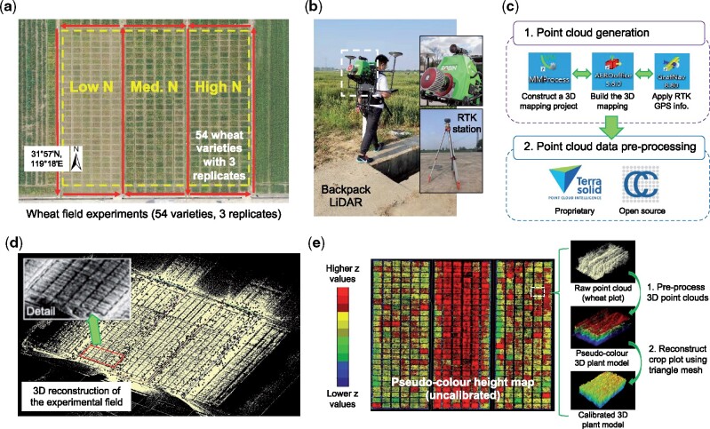
Figure 1.
The data acquisition procedure using a backpack LiDAR device together with raw point cloud data generated through pre-processing a LiDAR-acquired 3D point cloud file. A, An overhead orthomosaic image of the field trial area showing 486 6-meter winter wheat varieties with three levels of N fertilization treatments (i.e. 0, 180, and 270 kg N ha−1). Red arrows represent the grid-style mapping method carried out by a LiDAR operator outside the plots. B, The backpack LiDAR device (ROBIN Precision) and a RTK base station are used for 3D field phenotyping. C, A high-level workflow of the pre-processing software used to generate RTK-tagged point cloud data collected by the backpack LiDAR. D, The raw point clouds generated for the trial area. E, Initial height-based analysis with uncalibrated 3D points, which were colored according to z-values, and example plot-level images using raw 3D points, height values, and triangle mesh.

