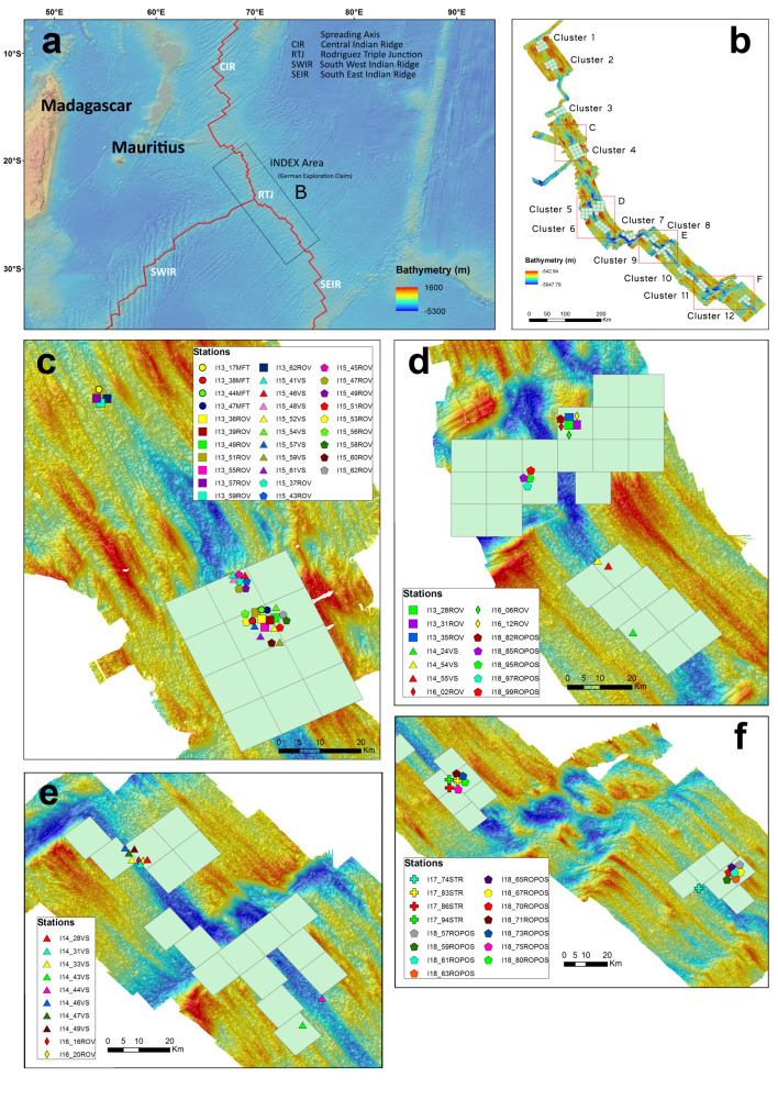
Figure 1.
Locations of imagery stations within the INDEX exploration area. a) Overview map of the southwestern Indian Ocean showing the ridge spreading axes (red line). b) Cluster 1-12 of the GLA for polymetallic massive sulphide exploration. The red boxes show the areas enlarged in C-F; each includes imagery transects conducted in each area. c) MESO area and Cluster 4. d) Cluster 5 and 6. e) Cluster 8 and 9. f) Cluster 11 and 12. Bathymetry data provided by the Federal Institute for Geoscience and Natural Resources (BGR).

