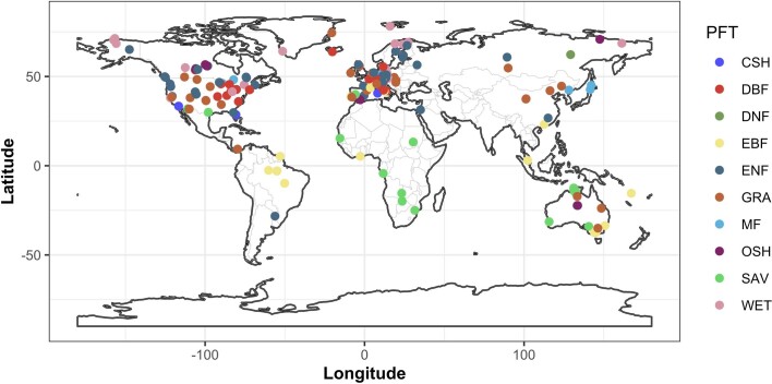
Extended Data Fig. 1. Map of the 203 FLUXNET sites used in this analysis.
Colours represent different plant functional types according to the IGBP classification. IGBP classes are: CSH (close shrublands); DBF (deciduous broadleaved forest), DNF (deciduous needleleaf forests), EBF (evergreen broadleaved forest), ENF (evergreen needleleaf forest), GRA (grasslands), MF (mixed forest), OSH (open shrublands), SAV (savannah), and WET (wetlands). The map was generated with the ggplot2 R package74. The shape files used to create the maps were downloaded from https://github.com/ngageoint/geopackage-js.

