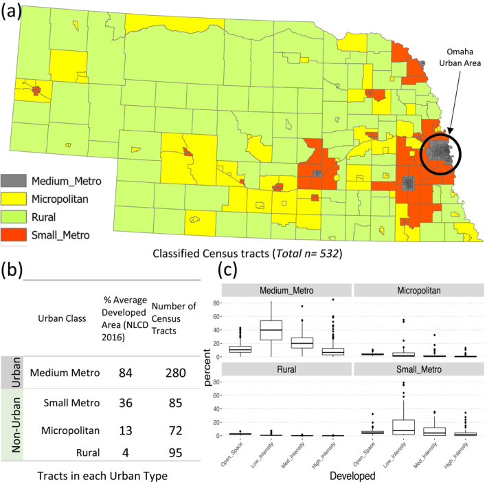
Figure 1.

Classification of Nebraska’s tracts (a) The four classes of urban type considered for the Environmental Vulnerability Index mapping of Nebraska. (b) The number of tracts in each considered class, and average developed area, (c) Boxplots of percentages of the four types of developed land types in each of the considered classes.
