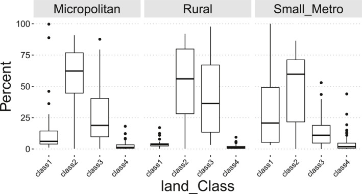
Figure 2.

The distribution of area percentage of four land type classes in three Non‐Urban groups of tracts (Figure 1). Classes are composed of land cover types in National Land Cover Database 2016 that have similar Normalized Difference Vegetation Index summer values. Class1 consists of the four developed land types and Barren Land. Class2 includes Deciduous Forest, Evergreen Forest, Mixed Forest, and Cultivated Crops. Class3 consists of Shrub/Scrub, Grassland/Herbaceous, and Pasture/Hay. Finally, Class4 includes Woody Wetlands, and Open Water.
