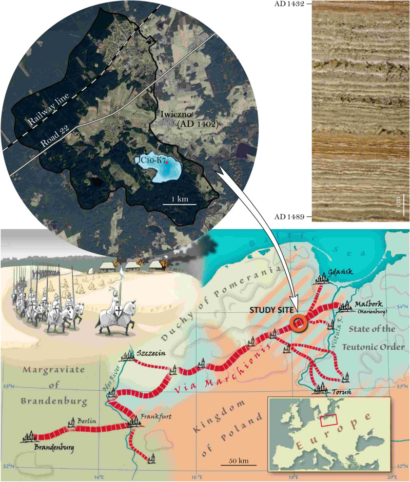
Figure 1.
Present day location of Lake Czechowskie with coring site and catchment and modern road and railroad locations (upper left, image
source: air image provided by Head Office of Geodesy and Cartography, Warsaw, Poland). Upper right: core photograph showing the varved sediment interval from AD 1489 – 1432. Bottom: Course of the via Marchionis and location of the lake (red circle) on a map which provide special to this manuscript by Piotr Kann.

