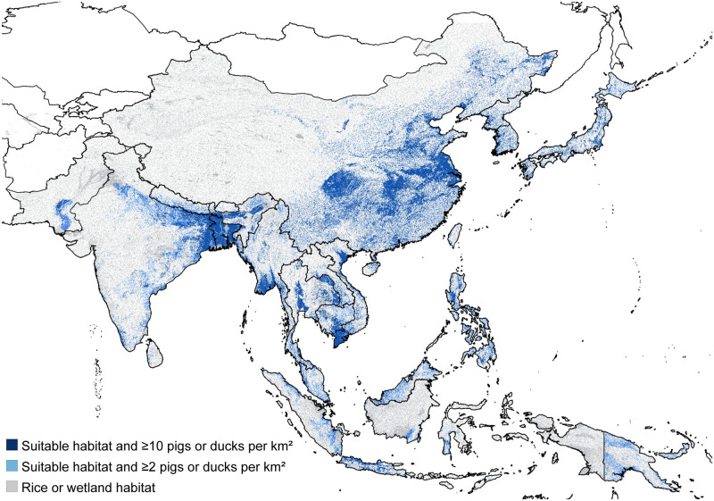
Fig 1. Map of the areas estimated to be suitable for endemic JEV transmission.
Grey represents land areas classified as either wetland or rice cultivation and was used as the upper bound for the extent of the at-risk population. Dark blue represents the lower bound on the extent of the at-risk population and only includes suitable habitat areas that have a combined density of domestic pigs and ducks of at least 10 per square km. Light + dark blue combined represents the default extent of the at-risk population and includes areas with wetland or rice cultivation that also have suitable environmental conditions for the mosquito vector population and a combined density of at least 2 domestic pigs and ducks per square km. Uncolored areas of the map are not considered as at-risk for endemic JEV transmission. The base map layer was generated using the geoBoundaries Comprehensive Global Administrative Zones (CGAZ) dataset available at https://github.com/wmgeolab/geoBoundaries/raw/main/releaseData/CGAZ/geoBoundariesCGAZ_ADM0.zip.

