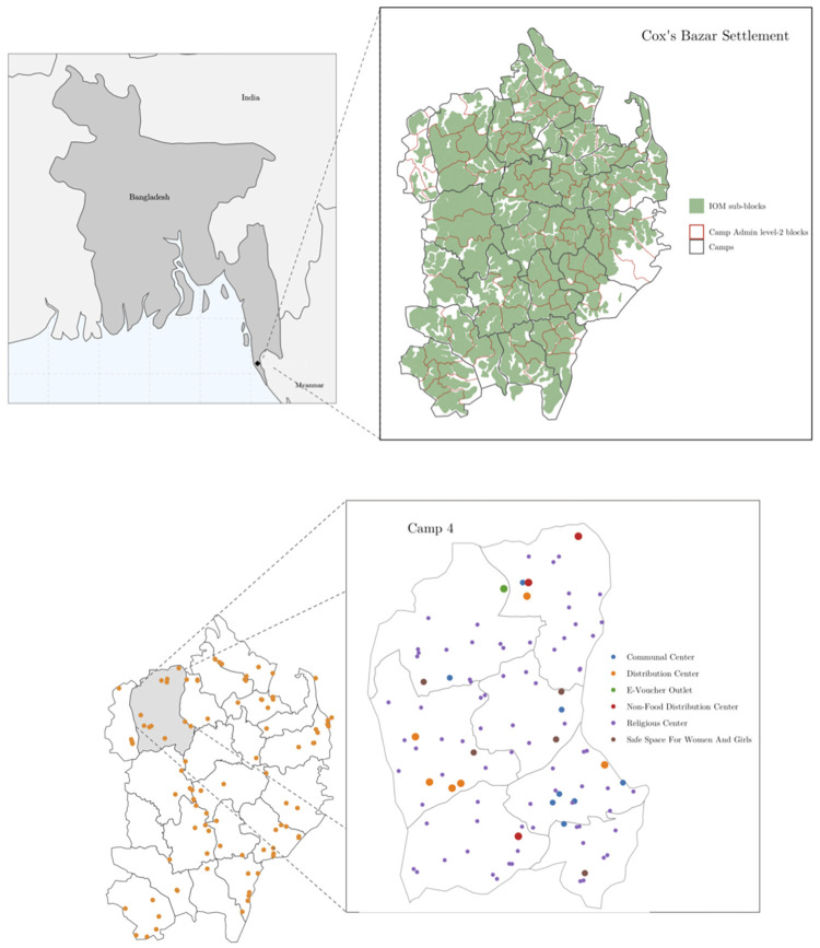
Fig 1. Digital twin geographic and location information.
Upper left: Map of Bangladesh showing location of the Cox’s Bazar settlement. Upper right: Map of the modelled expansion site with three geographical layers. Lower left: modeled distribution centers. Lower right: Detailed view of Camp 4 showing six types of modeled locations. Basemaps from [22, 23].

