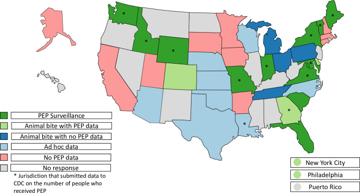
Fig 1. Categorization of surveillance systems with data related to postexposure prophylaxis by jurisdiction–November 2018.
A map indicating the category of PEP data captured from jurisdiction-level surveillance systems as reported by survey respondents in November 2018. These mutually exclusive categories are: PEP surveillance, animal bite surveillance with PEP data captured, animal bite surveillance with no PEP data captured, ad hoc data sources for PEP or animal bites (e.g., emergency department data or submissions for animal testing for rabies), and no PEP data captured. *Indicates jurisdictions that submitted data to the Centers for Disease Control and Prevention (CDC) about the number of people who received PEP. Base map from Natural Earth (Natural Earth » 1:110m Cultural Vectors - Free vector and raster map data at 1:10m, 1:50m, and 1:110m scales (https://www.naturalearthdata.com/downloads/110m-cultural-vectors/)).

