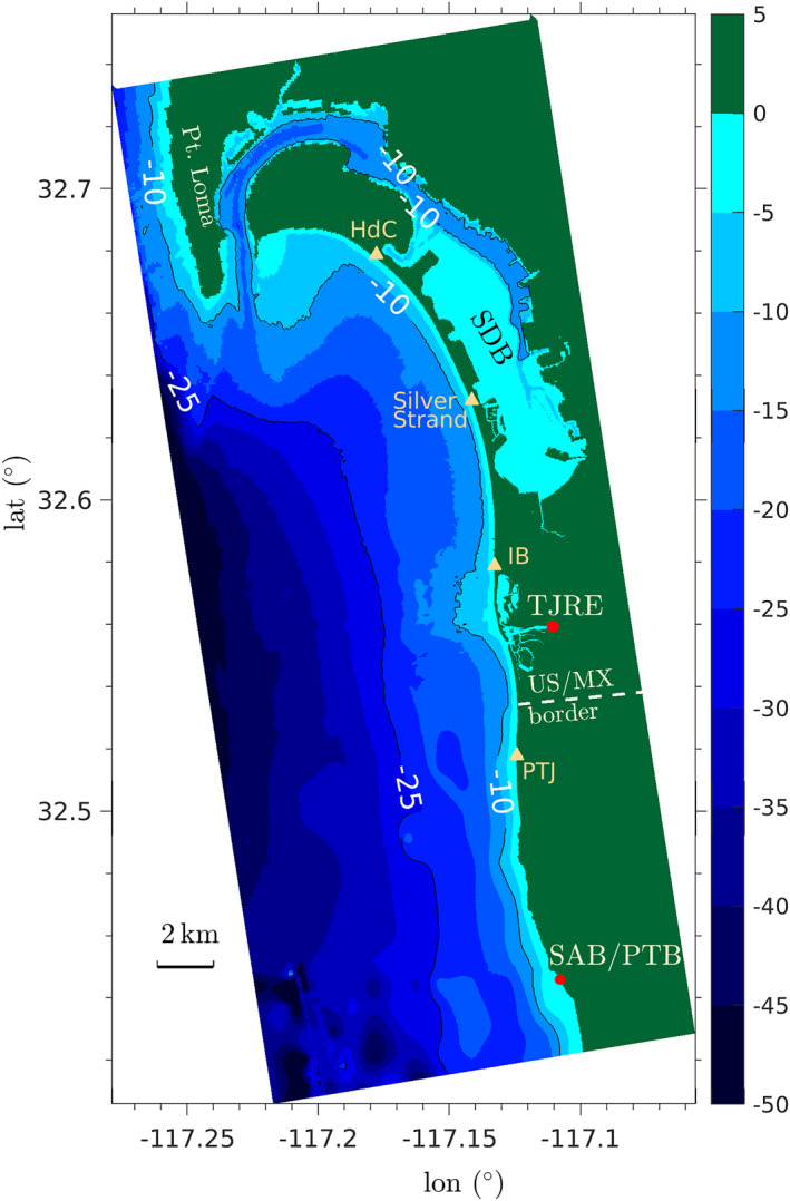
Figure 1.

San Diego Bight (US/Mexico border region) model domain as a function of latitude and longitude spanning Pt. Loma to south of Punta Bandera (PB) Mexico with bathymetry shown in color. The untreated wastewater sources at the Tijuana River Estuary (TJRE) and the San Antonio de los Buenos outfall located at the shoreline of Punta Bandera (SAB/PTB) are indicated as red dots. Point Loma and the US‐Mexico border are labeled. Orange triangles indicate the popular beach locations of Playas Tijuana (PTJ), Imperial Beach (IB), Silver Strand State Beach, and Hotel del Coronado (HdC).
