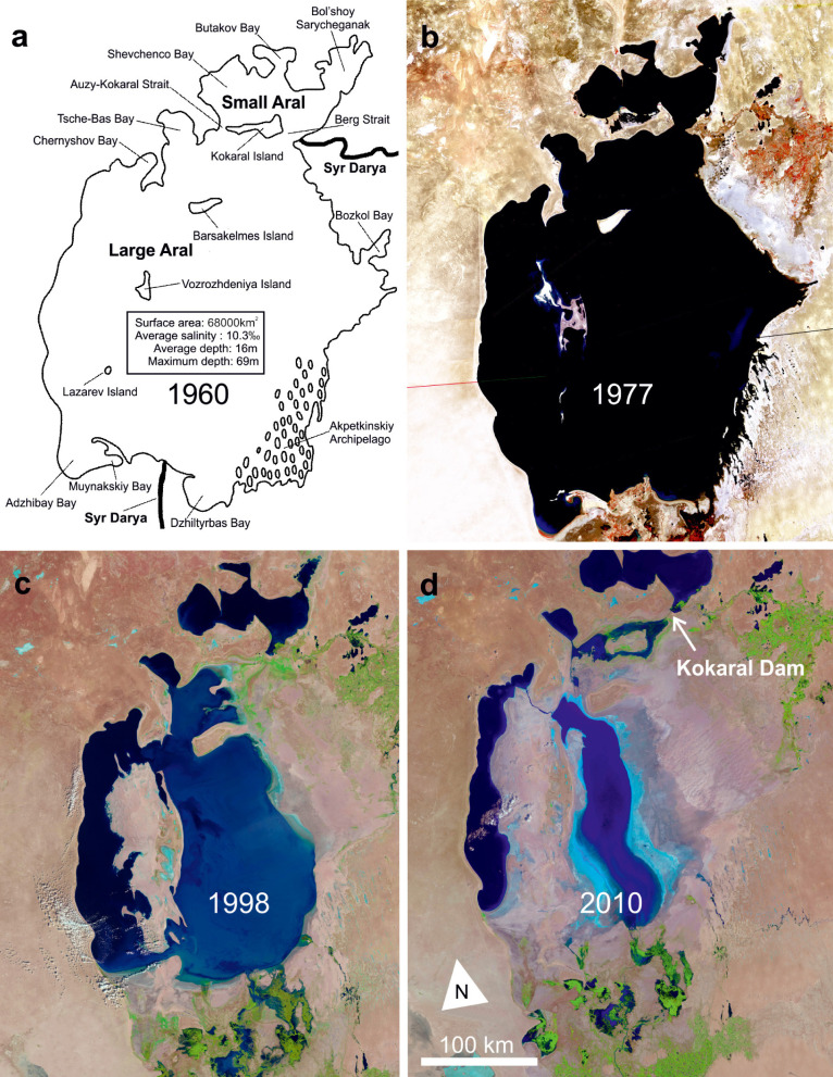
Fig. 2.
The original Aral Sea around 1960 (a) and NASA Landsat images (b–d) documenting the modern regression (source NASA); separation of the northern Small Aral and the southern Large Aral had occurred by 1998; in 2010 the continued regression resulted in fragmentation of the Large Aral into several hypersaline water bodies; in contrast, construction of the Kokaral Dam (d) now preserves the water level in the Small Aral and allows it to gradually increase.

