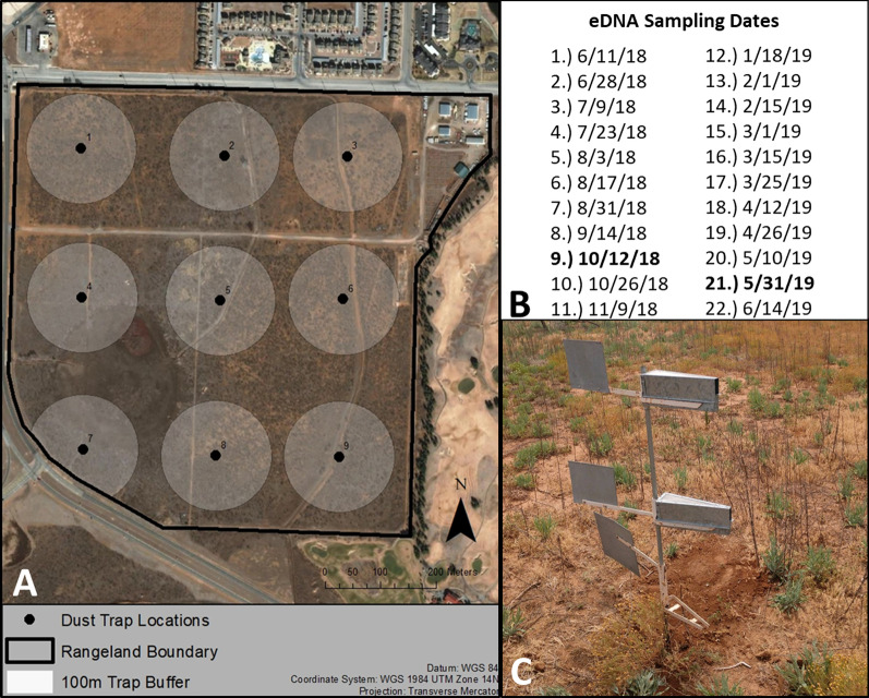
Fig. 1.
The Texas Tech University Native Rangeland (Lubbock County, TX, United States) study site where both the traditional and metabarcoding plant community surveys were conducted. A The points and numbers represent individual Big Spring Number Eight dust trap locations while the buffers around each point represent the 100 m traditional survey extent. For our study site, the wind predominantly blows from the west/northwest to the east/southeast. B The sampling dates for our airborne eDNA metabarcoding survey. The dates in bold represent the corresponding times of our two traditional surveys. C The Big Spring Number Eight Dust traps that collected the airborne eDNA

