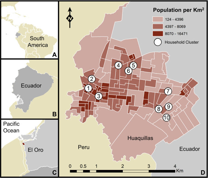
Fig 1. Map of the study area.
Huaquillas is located within South America, Ecuador, and El Oro province. The map includes household cluster locations where sampling took place (white circles denote areas where up to 5 houses were sampled, but precise household locations are not shown, to protect identities) and the population density of Huaquillas at the census tract level. A) location of Ecuador, B) location of El Oro province, C) location of Huaquillas (red), D) Huaquillas population and sampling sites. This figure was produced in ArcMap 10.6.1 (ESRI, Redlands, CA) using shapefiles freely available from the Natural Earth dataset ver. 4.1.0 (naturalearthdata.com) and georeferenced census data (2010) provided by the Ecuadorian National Institute of Statistics and Census (INEC) and edited by JLM.

