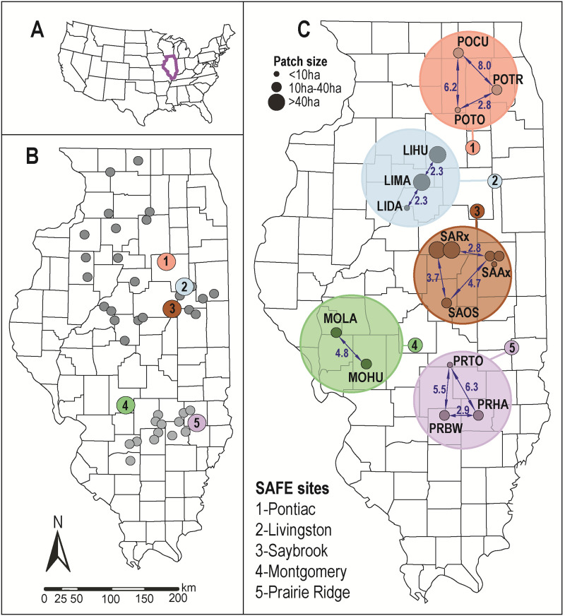
Fig 1. Map depicting State Acres for Wildlife Enhancement (SAFE) restoration sites in Illinois.
(A) Location of Illinois (purple) in the USA. (B) Distribution of SAFE sites (circles) in Illinois: color = sampled sites; dark grey sites in the Grand Prairie region; light gray = sites in the Southern Till Plain. (C) Schematic distribution of restoration patches (small circles) at sampled sites (large circles): arrows = inter-patch distances (in km); circle size = patch area (in ha). The map was generated in ArcGIS 10.4.1 using publicly available data downloaded from government institutions, with boundaries derived from Topologically Integrated Geographic Encoding and Referencing (TIGER) data via U.S. Census Bureau. Additional details on patches provided in S1 Table.

