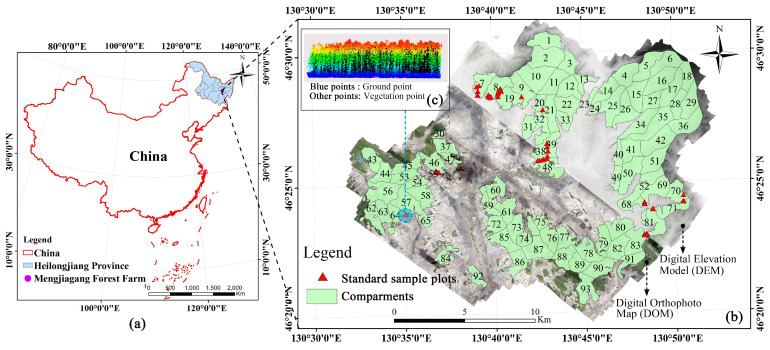
Figure 1.
Study area profile and multi-source dataset. The figure shows the specific location of the Mengjiagang forest farm (b) in China (a). The distribution of ground standard sample plots in forest compartments, the DOM used for extracting vegetation indices, and the DEM for extracting terrain factors are included in (b). (c) shows the LiDAR point cloud data of a ground standard plot.

