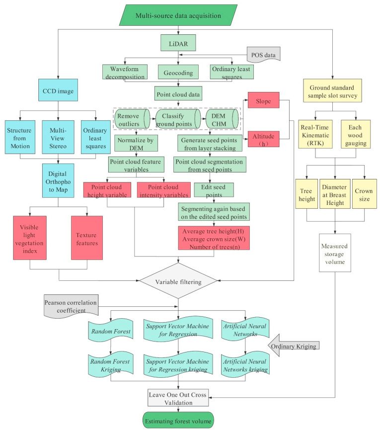
Figure 4.
Technology roadmap. Multi-source data are used to estimate forest volume, where blue is the processing method of the CCD image data source; green is the processing method of the LiDAR data source; yellow is the processing method of the ground standard sample data source; red represents the independent variables; white on the left represents the measured value; blue–green represents the estimation model.

