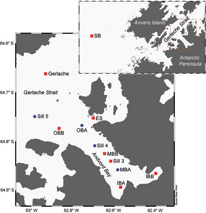
FIG 1.
Sampling stations in the present study, including Station B (SB) on the Antarctic continental shelf and stations within and adjacent to Andvord Bay in the Gerlache Strait. The map in the foreground shows a broader view of the west coast of the Antarctic Peninsula and Anvers Island, with the red box outlining the map of Andvord Bay shown in the background. Red squares indicate stations that were sampled and analyzed during both the austral spring and fall, while blue circles represent stations that were only sampled and analyzed during the austral spring.

