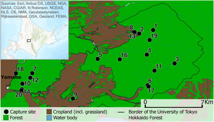
FIGURE 1.

The main map shows the locations of trapping sites within the University of Tokyo Hokkaido Forest, while the inset map shows the location of the study area within Hokkaido. Main map data source: National Land Numerical Information (land utilization tertiary polygon data) provided from the Japanese Ministry of Land, Infrastructure, Transport and Tourism (https://nlftp.mlit.go.jp/ksj/index.html; accessed: 2021/01/21) was edited to create this map
