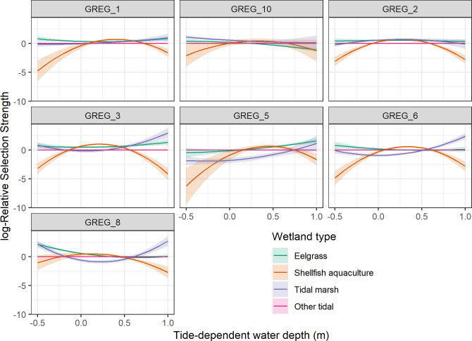
Fig 2. log-Relative selection strength and 95% confidence intervals of different tidal wetland types by seven GPS tagged great egrets at Tomales Bay, CA, 2017–2020, while accounting for tide-based changes in water depth.
Other tidal areas (the reference level) were mostly unvegetated inter- and subtidal mud flats. Water depth represents the average depth in the 10 m2 grid cell around where the bird was located. Negative values of water depth indicate the bird was located above predicted water level.

