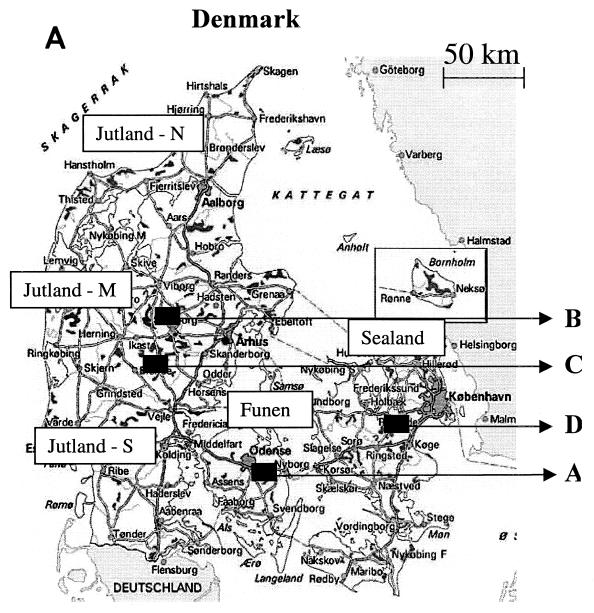
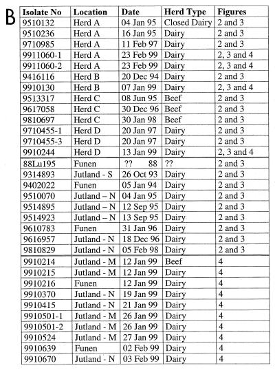
FIG. 1.
(A) Map of Denmark. The arrows indicate herds (A to D) from which BRSV was isolated during recurrent outbreaks. The different regions of Denmark are indicated as north (N), mid- (M), or south (S) Jutland; Funen; and Sealand. (B) All isolates included in the phylogenetic analysis. The first two digits of the isolate name indicate the year of isolation; the location indicates either herd designation or geographic location illustrated in panel A. Finally, the herd types and references to the phylogenetic tree(s) (figure number) in which the isolates are included are also listed.


