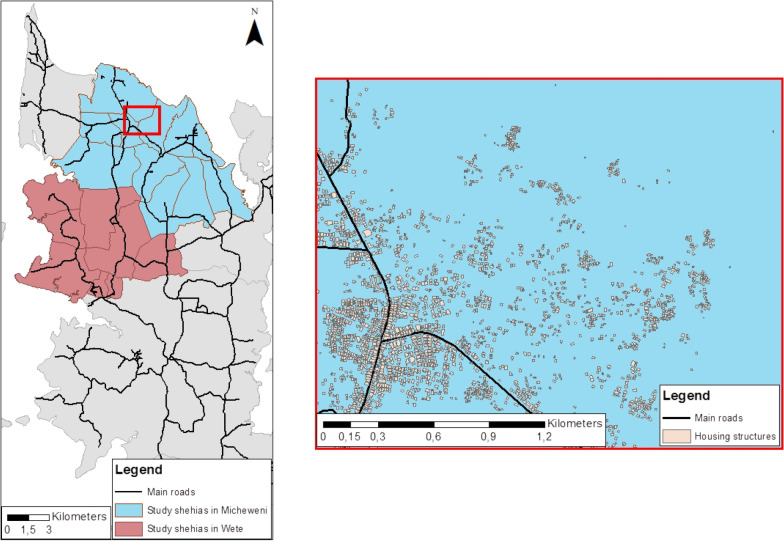
Fig. 1.
Study area of the SchistoBreak project in Pemba, Tanzania. The exemplary section shows the distribution of housing structures and main roads. The image base map (United Republic of Tanzania—Subnational administrative boundaries) was downloaded from OCHA services (https://data.humdata.org/dataset/tanzania-administrative-boundaries-level-1-to-3-regions-districts-and-wards-with-2012-population). The data source is: Tanzania National Bureau of Statistics/UN OCHA ROSA. The data are published under the following license: Creative Commons Attribution for Intergovernmental Organisations [CC BY-IGO; (https://creativecommons.org/licenses/by/3.0/igo/legalcode)]. Additionally, we received written permission to use and adapt the data from the UN Office for the Coordination of Humanitarian Affairs (OCHA). Additional shapefiles for the map (shehia boundaries and housing structures) were provided by the Zanzibar Commission for Lands to the Zanzibar Neglected Diseases Program

