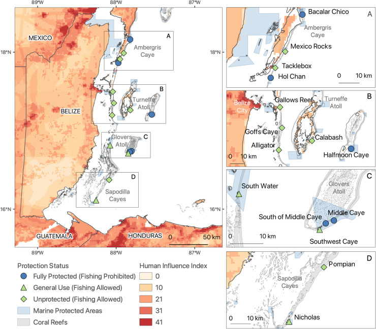
Fig 1. Study sites along the Belizean Barrier Reef.
Sites are categorized by management level (fully protected, general use, unprotected) and prescribed protection status (fishing prohibited or allowed). Fishing is allowed in general use and unprotected sites (green) and is prohibited in fully protected sites (blue). Light blue polygons indicate the extent of MPAs. The Human Influence Index (HII), estimated at 1-km resolution for 1995–2004 across the landscape adjacent to study sites, is indicated in shades of light orange to red. GADM source: Database of Global Administrative Areas, Version 3.6 available at www.GADM.org.

