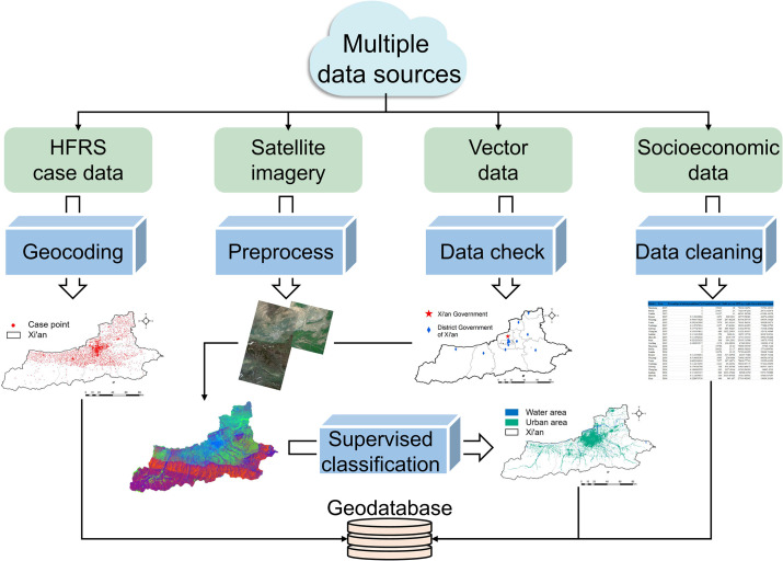
Fig 1. Multiple data sources and establishment of a geodatabase.
The maps in the figure were produced in ArcGIS 10.8 (ESRI, Redlands, CA, USA) using shape files representing Xi’an City which were obtained from the basic geographic database in National Catalogue Service For Geographic Information of China (https://www.webmap.cn/mapDataAction.do?method=forw&resType=5&storeId=2).

