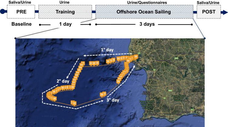
Figure 1.
Sketch of the experimental protocol and map showing the navigation route. Data were collected before departure (PRE), during the inshore navigation (Training) during each day of Offshore Ocean Sailing (from 1° to 3° day), and at arrival (POST). GPS data and map were obtained with Spot Gen3, SPOT LCC, Globastar, Inc, Covington, Louisiana, USA. Maps by Google, Inst. Geogr. Nacional. Modified geographic map was edited with Microsoft Office PowerPoint 2007, Microsoft Corporation, Washington, USA, version 16.16.27, https://www.microsoft.com/it-it/microsoft-365/powerpoint and at the top was insert the experimental protocol timeline.

