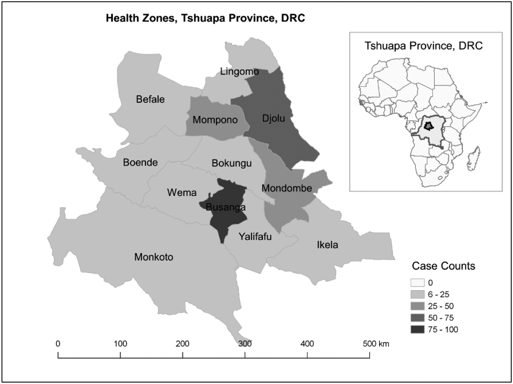
Figure 2. Geographical distribution of laboratory-confirmed varicella cases in Tshuapa Province, Democratic Republic of the Congo by Health Zone, September 2009–February 2014 (n = 366)ab.

aThe distribution of varicella cases by health zone are as follows: Busanga (27%), Djolu (20%), Mondombe (13%), Mompono (9%), Wema (6%), Ikela (6%), Boende (4%), Befale (4%), Bokungu (4%), Lingomo (3%), Monkoto (2%), and Yalifafu (2%).
bThe higher concentration of varicella cases identified in Busanga and Djolu could be due to involvement of these two areas, as well as Ikela, in a special monkeypox research project during 2013–2015. Busanga is a smaller area in which most people live near the main road, which may make it easier to reach and investigate suspected cases.
