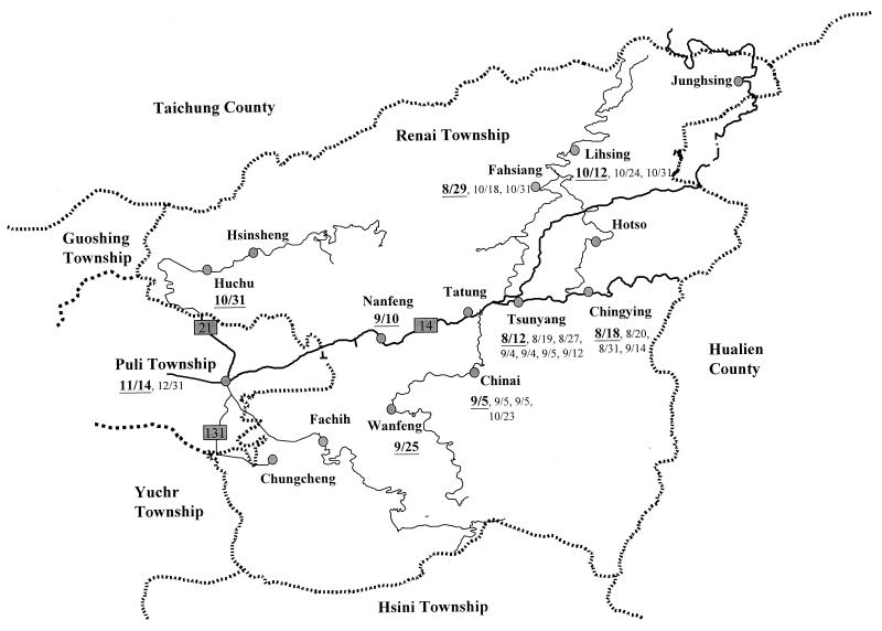
FIG. 1.
Map of 14 villages in Renai Township and the neighboring townships depicting the distribution of the S. flexneri 2a outbreak strain. The dates when an isolate of the outbreak strain was recovered from a specific village or township are indicated next to the villages or township, with the first date being in boldface and underlined. Dates are shown as month/day. Continuous lines represent the road systems, thick lines represent the main road, and thin lines represent branch roads.

