
FIGURE 2.
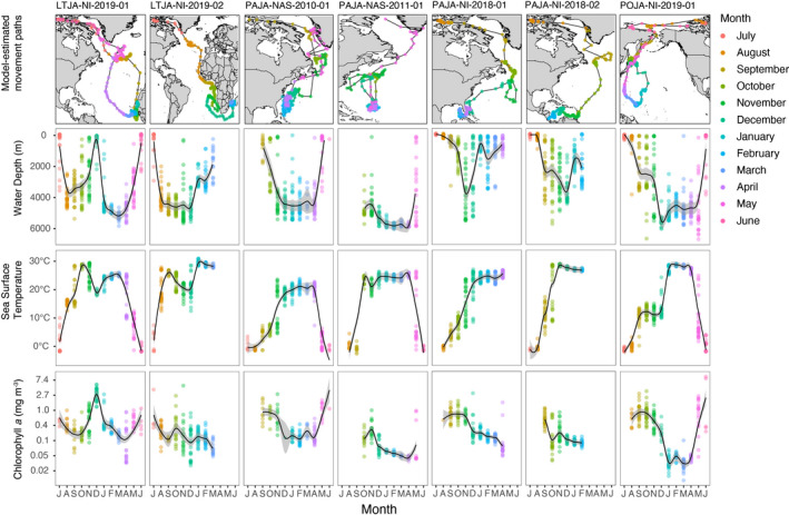
Habitats used by long‐tailed jaeger (LTJA), parasitic jaeger (PAJA) and pomarine jaeger (POJA) electronically tracked following breeding in the Canadian high Arctic. Points on maps indicate model‐estimated daily positions, color‐coded by month. Daily estimates of habitat variables are grouped and colored by month. Bathymetry (water depth), and chlorophyll‐a were derived from remotely sensed data (see methods for datasets used). SST was either recorded directly by the tag (GLS tags: PAJA‐NAS‐2010‐01 and PAJA‐NAS‐2011‐01) or were derived from remotely sensed data (Argos satellite tags). Time series begin in July when the birds were incubating eggs and tags were deployed. Solid black lines indicate a loess smooth of the daily estimates and shading around the line indicates the 95% confidence interval