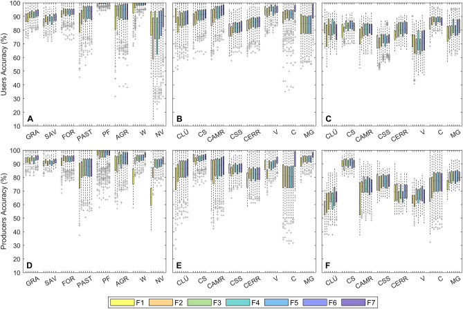
Figure 4.
Users and producers accuracies at classification stages 1 and 2. (A and D) Stage-1 formation level map UA (A) and PA (D), for each native vegetation, non-native vegetation and non-vegetated class (grass (GRA), savanna (SAV), forest (FOR), pasture (PAST), plantation forest (PF), agriculture (A), water (W) and non-vegetated (NV)) for the seven alternative feature spaces F1–F7. Stage-2 physiognomy level map UA and PA only (B and E) and combined stage-1 and 2 UA and PA (C and F) for, for each physiognomy ((campo limpo úmido (CLÚ), campo seco (CS), campo rupestres (CAMR), cerrado sensu stricto (CSS), cerrado rupestre (CER), vereda (V), cerradão (C) and mata de galeria (MG)), across the seven alternative feature spaces F1–F7. For each feature space, the classification process has been repeated 500 times with different training/validation vegetation reference data splits.

