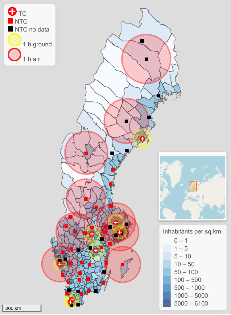
Fig. 1.
Map of Sweden showing the population density for each of Sweden’s 290 municipalities (inhabitants/km2, intervals closed at start, open at end) and estimated 1-h radii for transport to a trauma center or non-trauma center (round trip for prehospital team), with an ambulance helicopter 107 km (red circles) or ground ambulance 45 km for smaller cities and 35 km for larger cities (yellow circles). Trauma-receiving hospitals not reporting to SweTrau within the queried time period are shown in black. The southernmost trauma center, Skåne University Hospital, consists of two hospitals in two cities in close proximity, shown individually. For increased clarity, a few hospitals close to trauma centers have been omitted, and no 1-h radii for ground transportation is shown for non-trauma centers. Estimated 1-h radii only take round trip transportation time into account, no allowance has been made for other factors such as time spent on site, loading and offloading patients, traffic or weather conditions or the starting point for the prehospital team. The map provides an approximative visualization of the trauma care conditions in Sweden. The minimap shows the location of Sweden

