
Fig. 1.
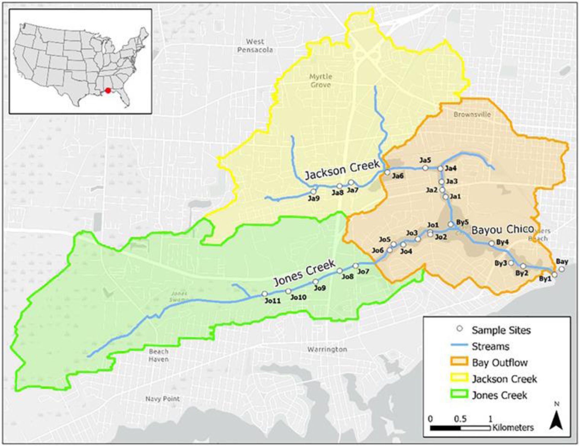
Bayou Chico watershed sub-basins and sampling locations (blue circles) along streams. The U.S. EPA Better Assessment Science Integrating Point and Nonpoint Sources (BASINS) modeling software (v. 4.1) was used for basin delineation. Elevation data (5-m resolution LiDAR data) and a stream network layer from the National Hydrography Dataset (NHD) were used as inputs.