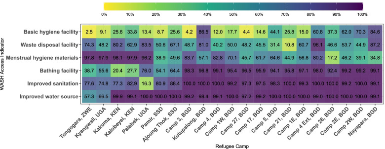
Fig. 1.
Percentage of Household with WASH Access Indicators in 21 Refugee Camps in 2019. This heat map illustrates the percentage of households with WASH access among 21 refugee camps in Bangladesh, Kenya, South Sudan, Uganda and Zimbabwe in 2019. On the y axis six selected WASH indicators are shown, and on the x axis the name of refugee camps followed by the abbreviation of the settlement country. The lighter the color in the box, the lower the percentage of households with WASH access in the corresponding refugee camp. This figure was created from the Standardized WASH KAP Surveys, UNHCR, 2019

