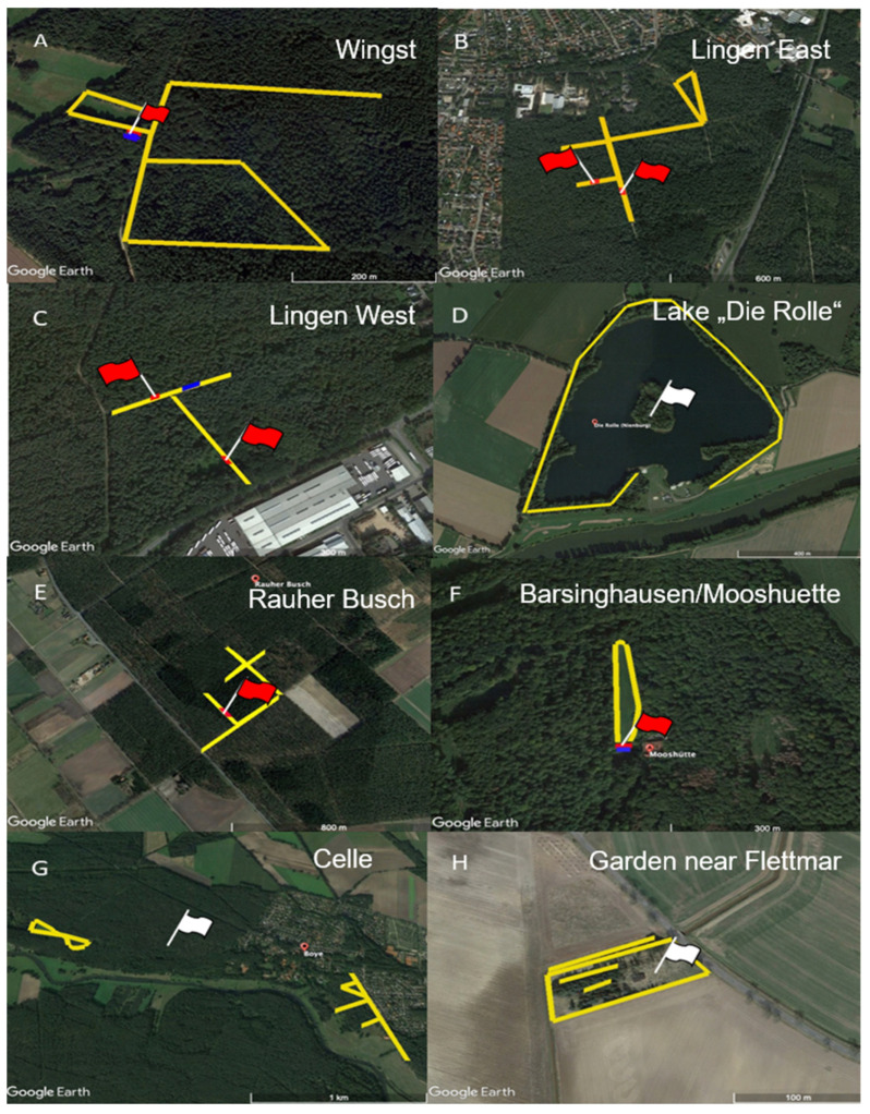
Figure 2.
Tick sampling locations: (A) Wingst (district of Cuxhaven, 53°43′45.42″ N, 9°2′38.67″ E), (B) Lingen East (district of Emsland, 52°30′13.32″ N, 7°20′0.68″ E), (C) Lingen West (district of Emsland, 52°30′17.20″ N, 7°16′40.42″ E), (D) Lake “Die Rolle” (district of Nienburg, 52°38′15.69″ N, 9°10′25.99″ E), (E) Rauher Busch (district of Nienburg, 52°32′36.00″ N, 8°52′41.00″ E), (F) Barsinghausen/Mooshuette (district of Hannover, 52°19′10.31″ N, 9°23′58.74″ E), (G) Celle (district of Celle, 52°38′13.18″ N, 10°1′40.07″ E), (H) garden near Flettmar (district Gifhorn, 52°31′23.49″ N, 10°19′54.55″ E). Ticks were sampled along the tracks marked in yellow. Virus detection sites of the current study are shown in red; previous detections at locations C, E and H are marked in blue. Coordinates refer to the virus detection site (red flags) or the central point of the flagging area (white flags), respectively. Images created with Google Earth Pro version 7.3.4. 8248.

