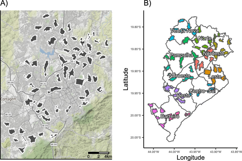
Fig. 1.
Spatial blocks used for randomization. a The political map of Belo Horizonte is shown with all enrolled clusters shown (n = 58). b The boundaries of the nine Distritos Sanitários (Health Districts) are shown in gray with color-coding indicating the spatial blocks used for randomization. Spatial blocks correspond to health districts except that the two districts with the largest number of clusters (Barreiro and Nordeste) were each divided into two spatial blocks. Overall allocation will be exactly 1:1 (intervention vs. control) and will be exactly 1:1 in blocks with even numbers of clusters and approximately 1:1 in blocks with odd numbers of clusters

