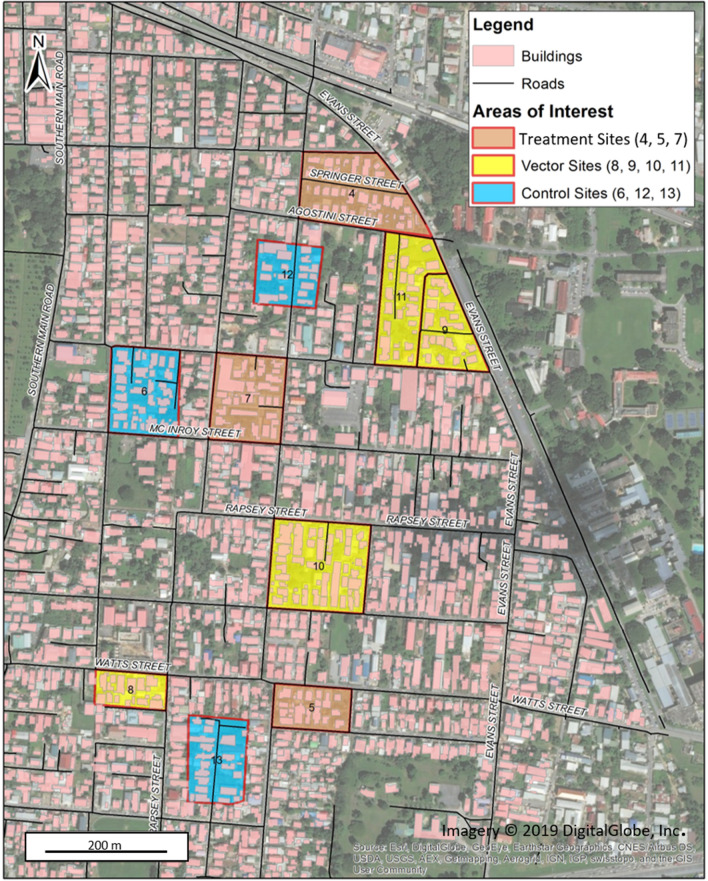
Figure 1.
Map of study area in Curepe, Trinidad, West Indies from July to December 2019. Block areas identifying sites for Control, Vector, and Treatment yeast-baited 10 L ovitrap placement are highlighted. Figure was prepared with Environmental Systems Research Institute (ESRI). "Topographic basemap.” "World Topographic Map." (Sept. 28, 2021). https://www.arcgis.com/home/item.html?id=10df2279f9684e4a9f6a7f08febac2a9. (May 21, 2019).

