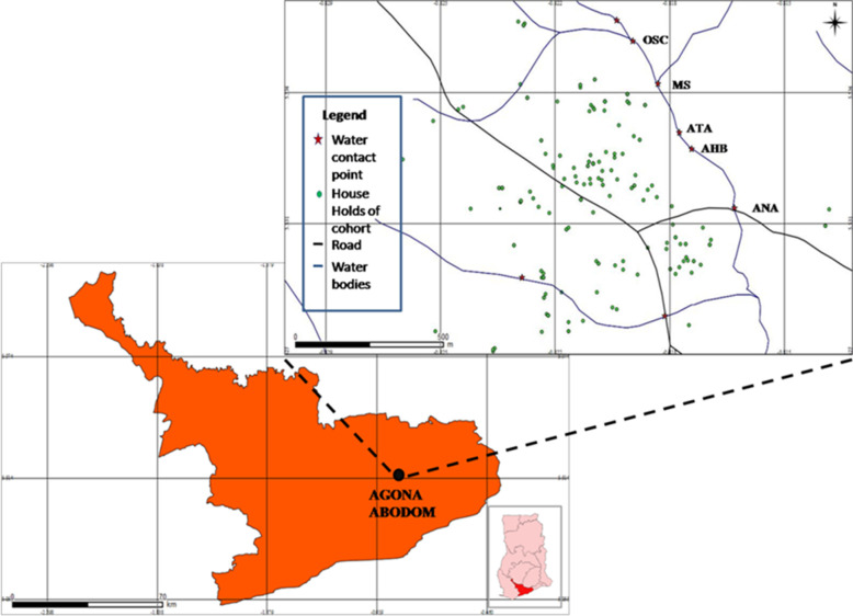
Fig 1. A map of the Central Region of Ghana with a zoom-in of the Agona Abodom community showing the spatial distribution of the water contact sites and houses of the 114 participants involved in the study.
Map of the Central Region of Ghana is courtesy the Centre for Remote Sensing and Geographical Information Systems (CERSGIS), University of Ghana, Legon (2012). GPS data on households of study participants and water contact sites were plotted using the QGIS Valmiera 2.2 software (Essen, Germany, 2012). Legend of major water contact sites: OSC = Oworaa sika; MS = Mansowaa; ATA = Atifi Awombrew; AHB = Awombrew near High Blows Park; ANA = Anaafo Awombrew. Inset: Map of Ghana indicating the location of the Central Region. Figure was developed by Elias Asuming-Brempong.

