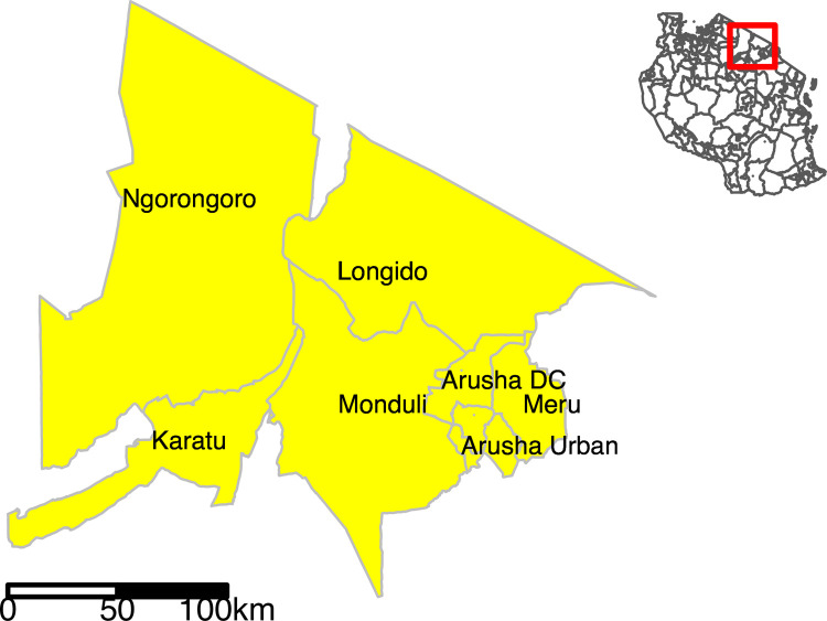
Fig 1. Map of Tanzania showing the seven administrative districts in Arusha Region (yellow shading) where the study was conducted.
Yellow shaded polygons in the insert show Arusha districts within an outline map of Tanzania (no shading). Map created using R software version 3.6.3 and the tmap R package [38]. Shape files for administrative boundaries from the 2012 census were sourced from the Tanzania National Bureau of Statistics (https://www.nbs.go.tz/nbs/takwimu/references/Licence-Agreement-NBS.pdf) [39].

