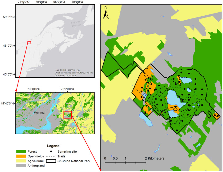
Fig 1. The location of the study site and sampling localities in Quebec Canada.
For illustrative purposes, the map is an aggregated representation of habitat types and land use categories based on ecoforestry inventory data obtained from the Ministère des Forêts, de la Faune et des Parcs du Québec (https://www.foretouverte.gouv.qc.ca/). The base map is from OpenStreetMap and OpenStreetMap Foundation.

