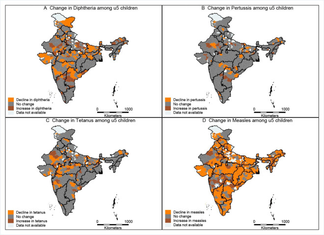
Figure 1.
District-level maps of India showing change in diphtheria (A), pertussis (B), tetanus (C) and measles (D), from 2013 to 2016. Source: India shapefiles were obtained from publicly available GitHub repository: https://github.com/datameet/maps/find/master. Maps in manuscript have been created by authors.

