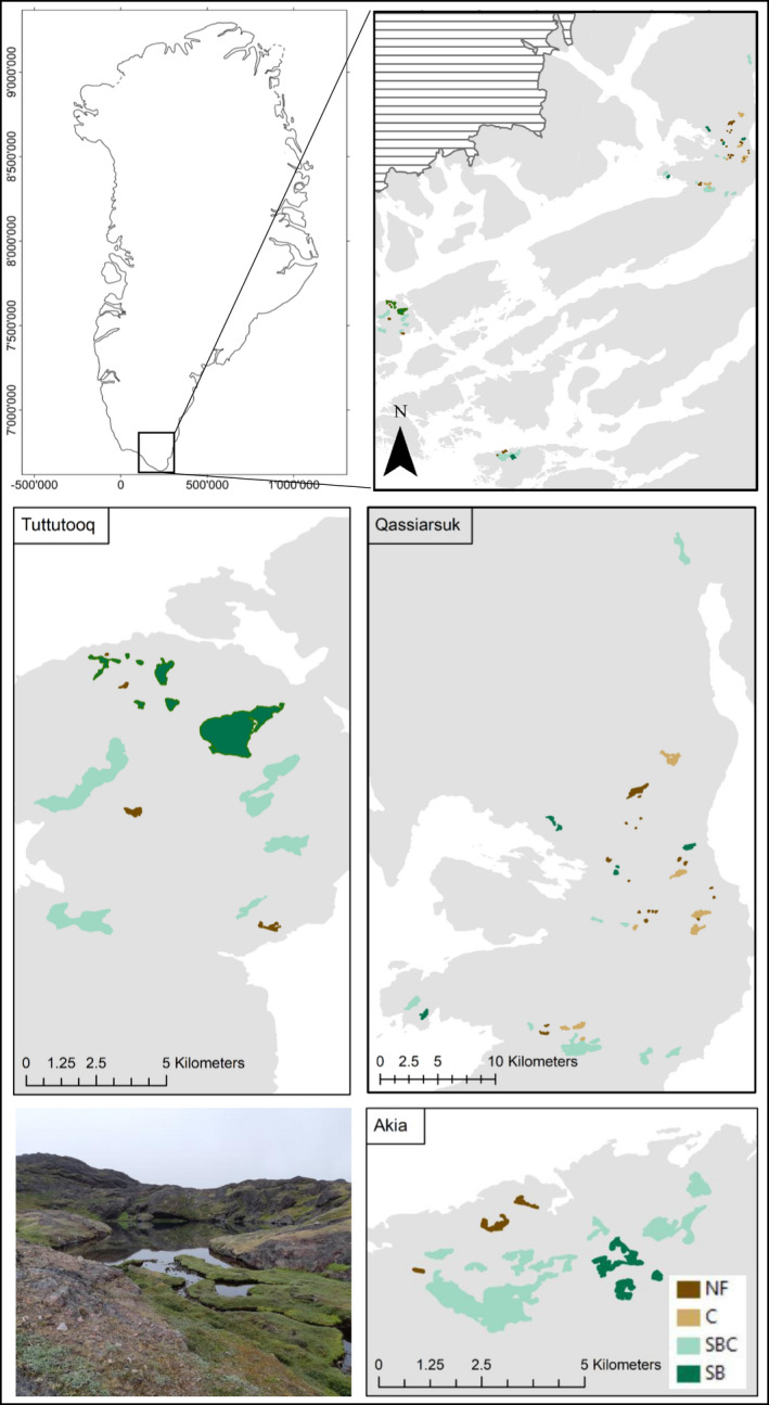
FIGURE 2.

Maps and image of study sites in southern Greenland. NF, no fish; C, charr only; SBC, stickleback and charr; SB, stickleback only. The striped area represents ice cover. Base maps provided by GEUS in the coordinate system WGS 1984 World Mercator
