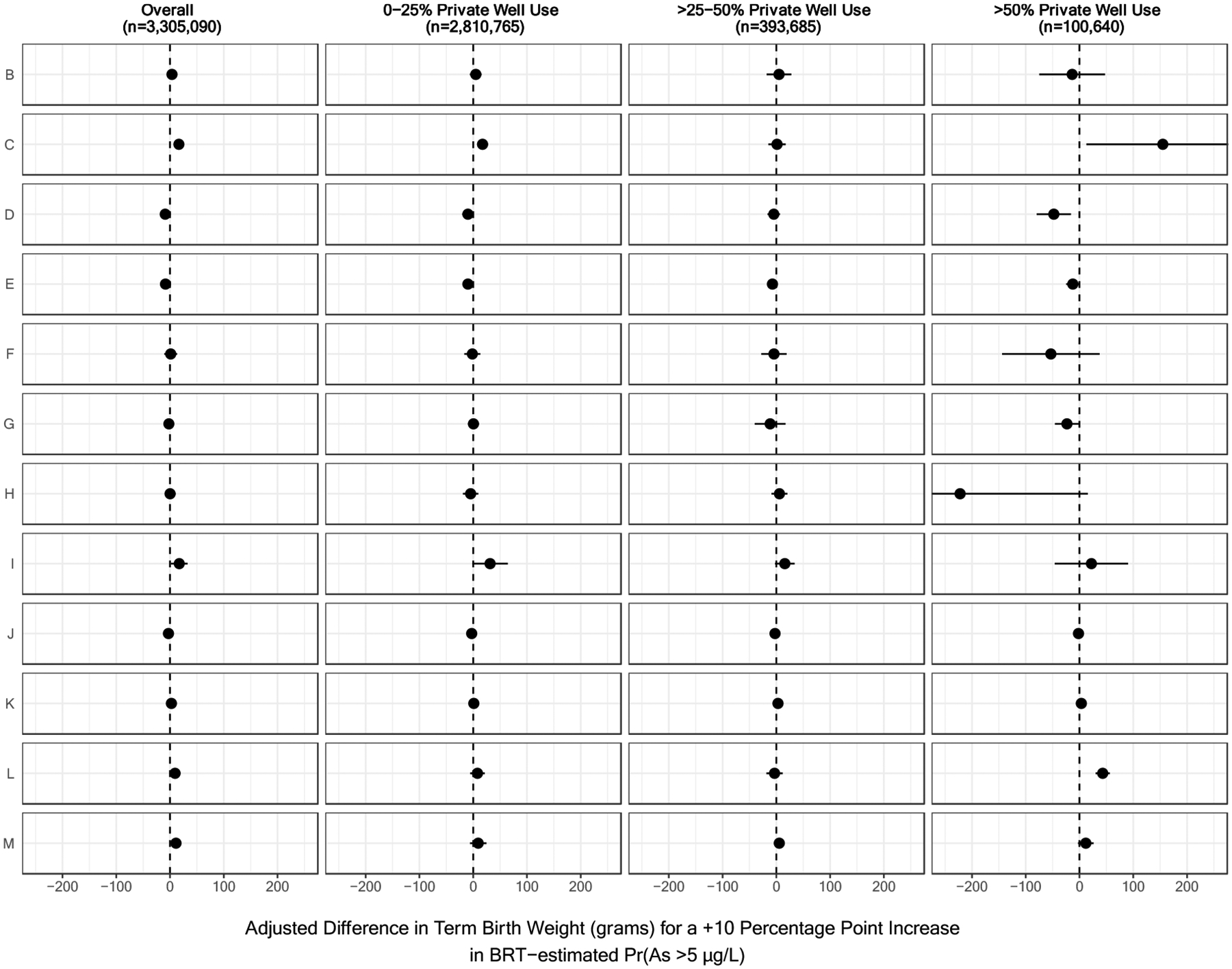
Figure 4.

Region-Specific Associations Between the Probability that Arsenic Concentrations Exceeded 5 μg/L and Term Birth Weight, Stratified by County-Level Rates of Private Well Use.
Results have been organized by U.S. Geological Survey Ground Water Atlas Regions as follows: B (California, Nevada), C (Arizona, Colorado, New Mexico, Utah), D (Kansas, Missouri, Nebraska), E (Oklahoma, Texas), F (Arkansas, Louisiana, Mississippi), G (Alabama, Florida, Georgia, South Carolina), H (Idaho, Oregon, Washington), I (Montana, North Dakota, South Dakota, Wyoming), J (Iowa, Michigan, Minnesota, Wisconsin), K (Illinois, Indiana, Kentucky, Ohio, Tennessee), L (Delaware, Maryland, New Jersey, North Carolina, Pennsylvania, Virginia, West Virginia), and M (Connecticut, Maine, Massachusetts, New Hampshire, New York, Rhode Island, Vermont). Ground Water Atlas Regions typically share hydrogeologic and hydrologic conditions across the major aquifers in each regional area (U.S. Geological Survey, 2016). BRT-estimated Pr(As >5 μg/L) refers to the probability that private well arsenic concentrations exceeded 5 μg/L as estimated by a boosted regression tree.
