
Figure 1.
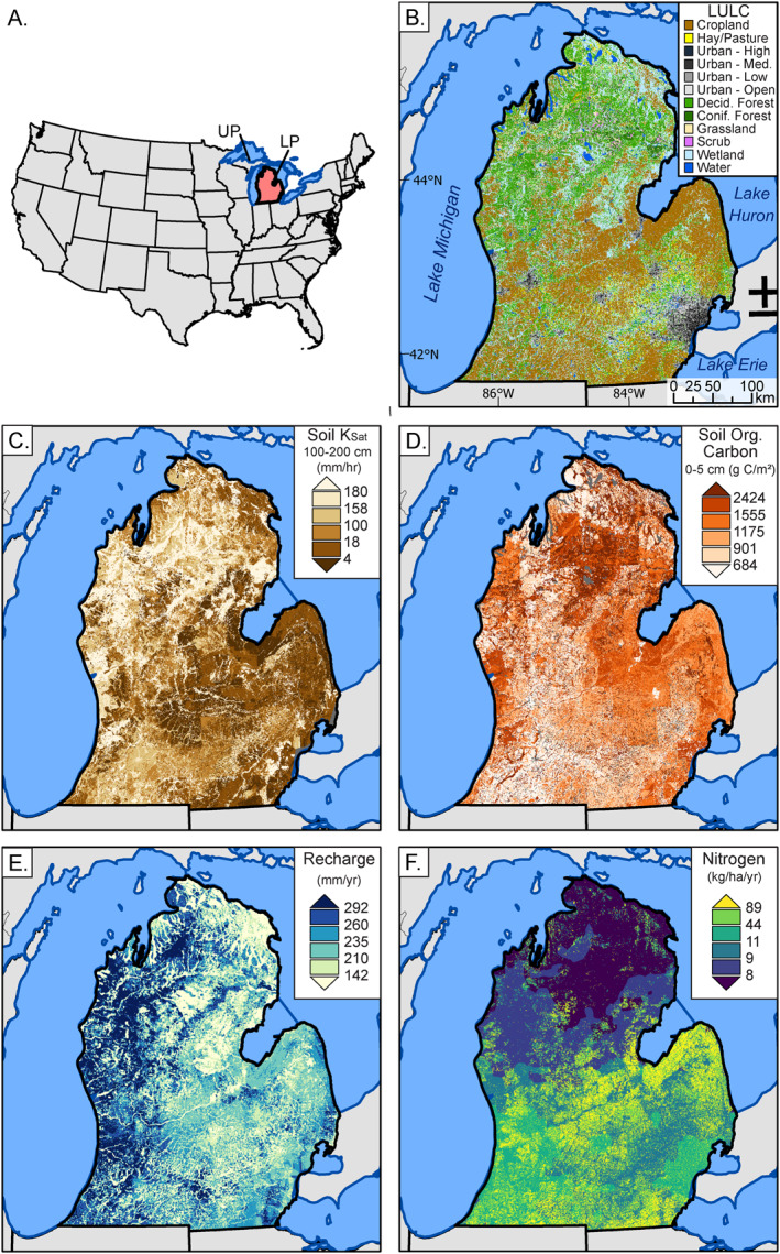
Study area with: (a) locator map within the Continental United States with Michigan's Lower Peninsula (study area) highlighted in red and labeled “LP”. The Upper Peninsula is labeled above “UP” and mostly obscured by the study area boundary, (b) land use land cover (National Land Cover Database, Homer et al., 2015), (c) soil hydraulic conductivity estimates (K sat), (d) soil organic carbon, (e) recharge, and (f) nitrogen inputs from SENSEmap (Hamlin et al., 2020a, 2020b). Breaks in legends are chosen using quantile intervals, where each color represents 16.7% of the data.