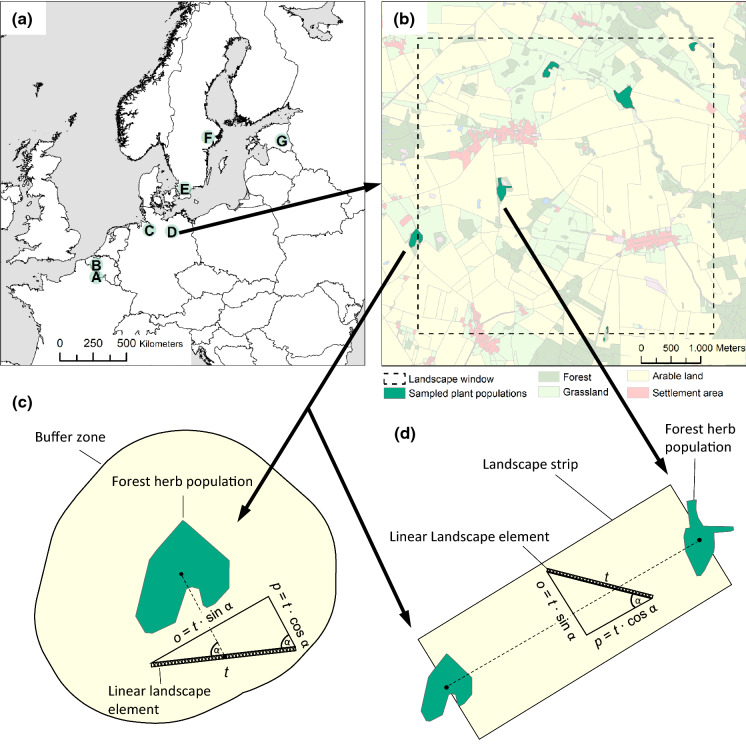
Fig. 1.
Overview on the study design. The seven 5 × 5 km2 landscape windows (a) are spread across temperate Europe from North France (A) over Belgium (B), West Germany (C), East Germany (D), and South Sweden (E) up to Central Sweden (F) and Estonia (G). In each agricultural landscape, we surveyed up to six populations of each species, here exemplified for Polygonatum multiflorum in East Germany (b). See Supp. Inf. 1 for detailed land-use maps of each landscape window, including locations of all sampled populations. The landscape surrounding the populations was analysed at the node level, i.e., in buffer zones of distances between 125 and 2000 m (c), and at the link level, i.e. in landscape strips between populations with width-to-length ratios between 1:7 and 2:3 (d). For linear landscape elements within buffer zones and landscape strips, we calculated not only the total length (t), but also the parallel (p) and orthogonal (o) length component in relation to the gene dispersal direction

